
EN 

Drone as a Service
Various spatial information and services are provided through
video information by drones.
You can easily use them anytime, anywhere.
DaaS
Drone as a Service
Provides 3D and Pano from drone images that are used for building spatial information in a form of URL for easier access to analyses and reports

DaaS 3D
Uploads the images taken for building 3D spatial data to the platform with simple 'drag & drop'.
The whole process automated with a parallel processing-based network provides various data analysis and reports


DaaS Pano (360°)
Makes HTML5-based results from several images
going through 360° Panoramic platform and a real-time auto-process (with mosaic and color correction process),
which automatically sends the result to users
in any OS & device.


DTM
Drone Traffic Mapper / Drone to Mapper
DTM provides novel solutions of aerial, water surface & ground surveying with drone’s Artificial Intelligence (AI) brain and eyes. Drone images become more valuable with Data Science Technology


DTM ML
When ML (machine learning) techniques are applied to drone image analysis, various forms of results can be generated, and by using drones, information about the whole and two-way lanes of the road can be effectively obtained beyond the limits of data acquisition by existing equipment.


DTM AI
Based on drones, artificial intelligence, big data, and blockchain, DTM provides a state-based management optimization system for various facilities and connections with existing systems.


CfSM

Car-free Street Mapping
Based on DTM ML, it removes cars using deep learning algorithms, and those integrated images are combined to make car-free street maps. Also, it could be used for self-driving car simulation data with the real road information and HD Safety Map.
AfGG
Auto-labeling 5G Geo-spatial Information HDS Map
AfGG solution creates an HDS (High-Definition Safety) Map with road marking information.
AfGG solution utilizes DTM ML to auto label the road markings (double yellow line, crosswalk, stop line, etc.)
or detect risk factors (pothole, crack, etc.) to gather road information.
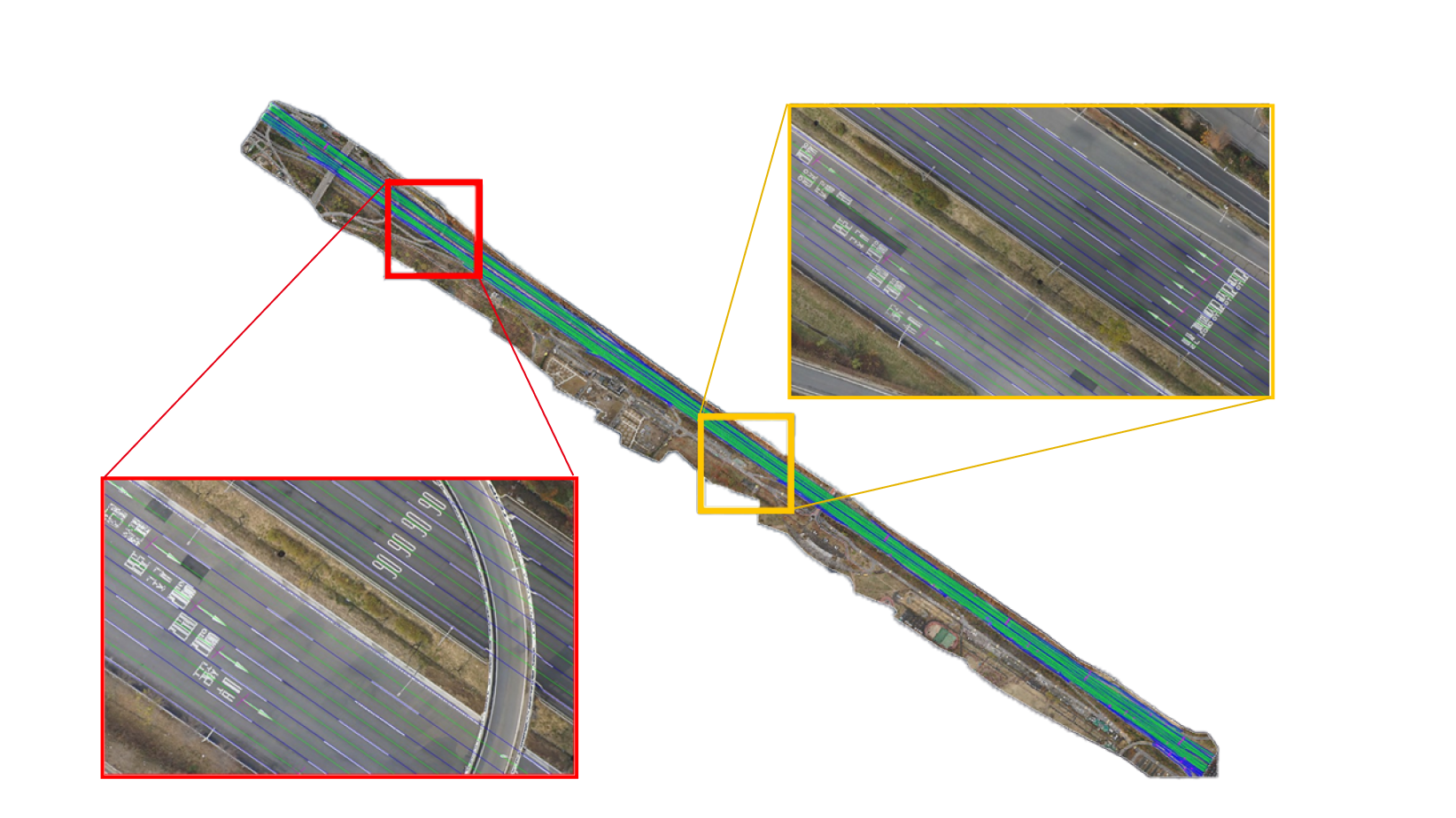
Through this technique, DroMii has the ability to form a map with various road marking
information risk factors that focus on the concept of automobile safety.